Barbican Members: Architecture Photo Walk
This self-guided architecture photo walk explores the public spaces, gardens and iconic Brutalist architecture of the Barbican.

Developed through the 1960’s, along modernist ‘Corbusian’* ideals, the Barbican Estate was conceived to be a new piece of the city by its architects Chamberlin, Powell and Bon*, proposing a radical transformation of how we live in buildings and cities.
When the Centre was opened by the Queen in 1982, she declared it ‘one of the modern wonders of the world.’ It has however always been controversial and was voted ‘London’s ugliest building’ in 2003.
This photo walk will challenge you to look at the Barbican differently through your camera (or smartphone) lens. At each stop, you’ll be given a different photographic theme as well as tips about how take eye-catching, dynamic photographs.
How to use
Tour Time: We recommend allowing at least one hour to complete.
Distance: 1.2km
How to use this route map: You're most likely viewing this on your mobile device - the button in the top righthand corner of this page opens a dropdown menu which you can use to jump between the route map and different stops.
Some photo prompts are during the walk between stops so make sure you read each section before walking it so you don't miss anything.
Glossary: At the end of the route is a glossary explaining the meaning of selected words and names. Throughout the route, the words included in the glossary are indicated by an asterix *.
Access: This route is wheelchair-accessible. In the final section you can reach St Giles Terrace by lift. You can find more information about access on our website.
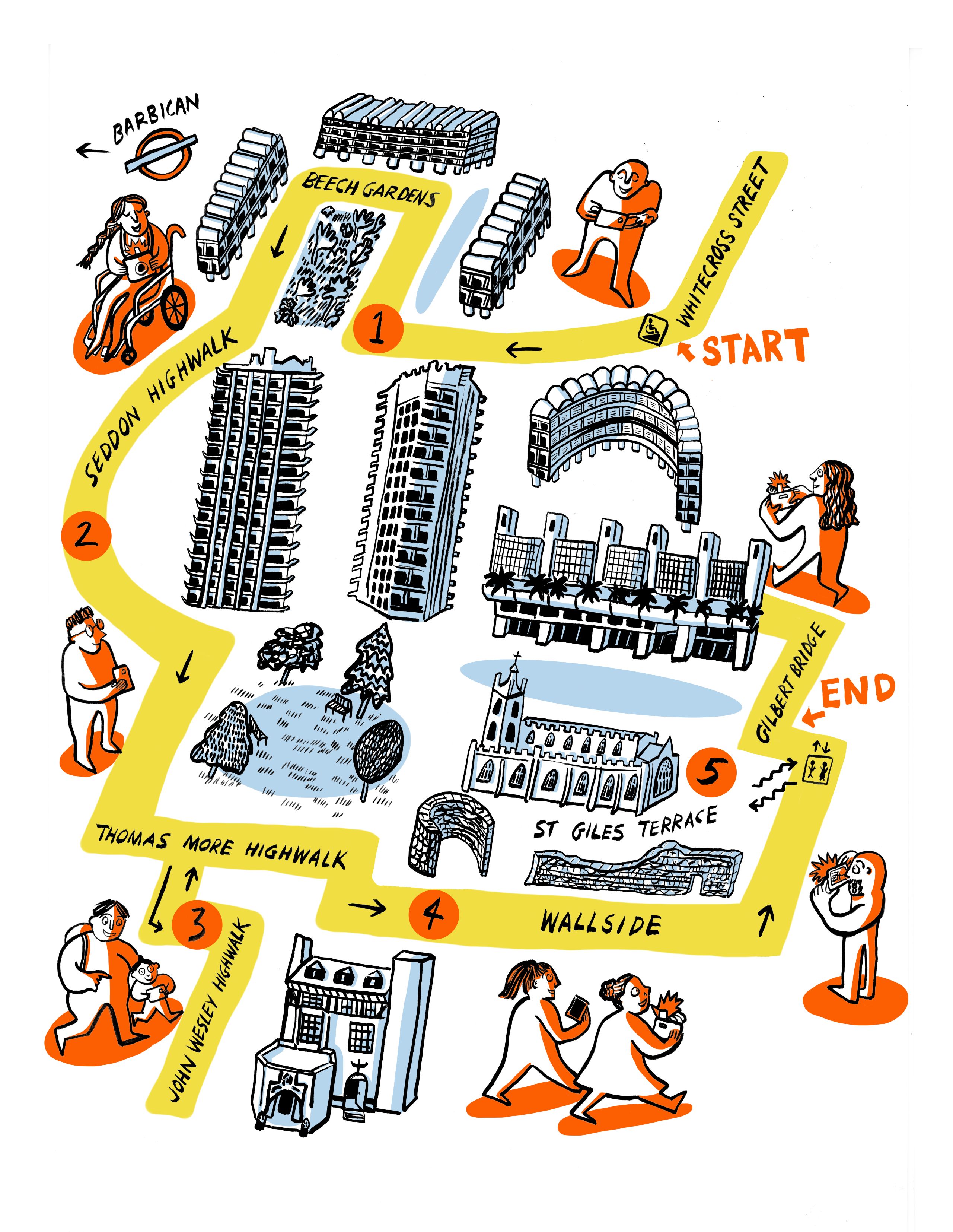
Route Stops
- Beech Gardens and Bryer Court Lake - Reflections
- Exploring the Highwalks - Shadow & Light
- Ironmongers Hall - Colour
- Wallside and the Roman Wall - Perspective
- The Church of St Giles Cripplegate - Place
- Gilbert Bridge
Share the tips and tricks you've learnt and post your photos on Instagram tagged with #BarbicanMembersPhotoWalk.
Stay safe: Please read our safety information so you can enjoy your visit. We ask that you maintain 2m social distancing from other visitors. If you enter the Centre you will be required to wear a face covering and check in using the NHS Test and Trace app, please have your mobile device ready.


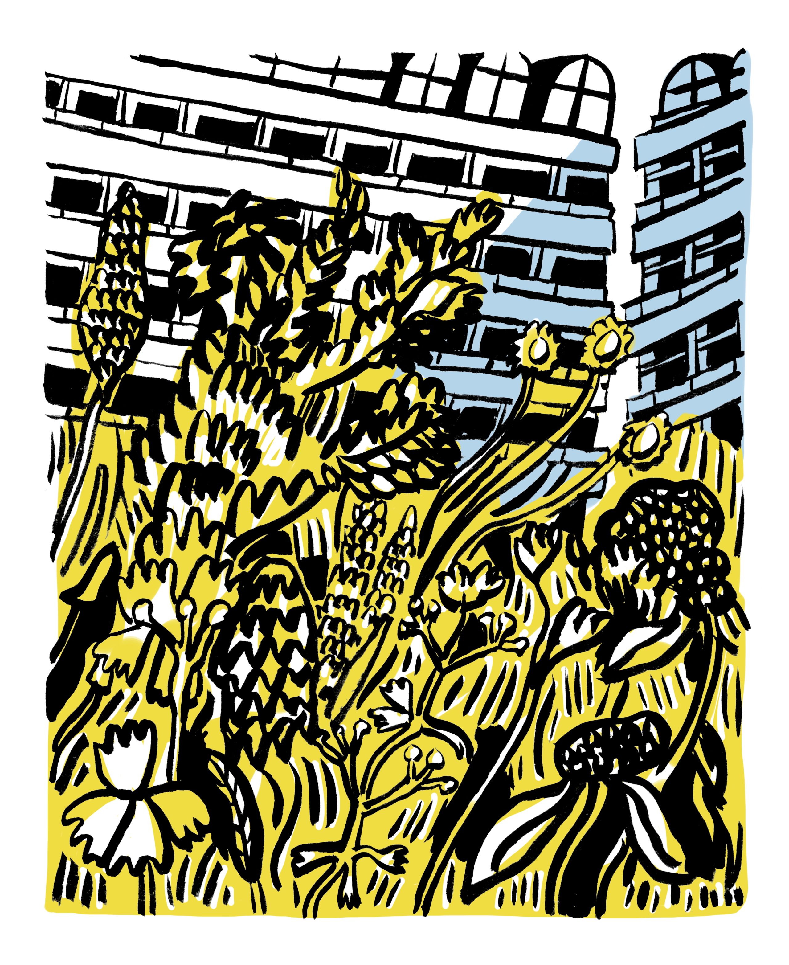

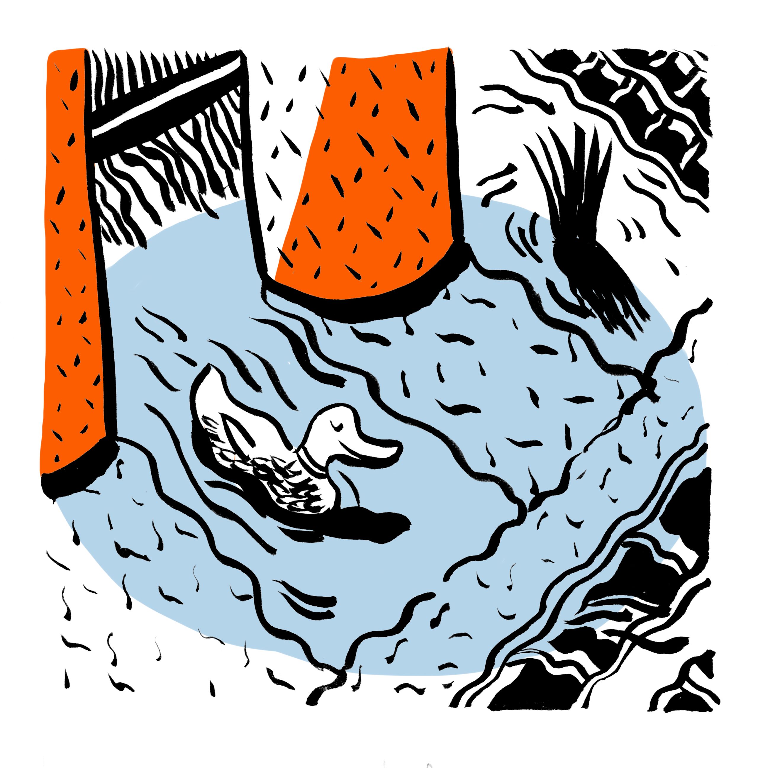


Beech Gardens and Bryer Court lake
Directions: Start at the corner of Whitecross Street and Beech Street by takin the slope up to podium level, walk along the podium in the direction of Barbican Station (following the signs), passing between Ben Jonson House to your right and Shakespeare Tower to your left. Beech Gardens and the adjacent shallow lake beneath Bryer Court will be on your right-hand side.
Walking time: 10 minutes
Distance: 0.3km
The planting throughout Beech Gardens was radically altered in 2013 by designer Nigel Dunnett* and allowed for a full re-waterproofing of the roof deck. The design uses plants as a green podium ‘roof’ unlike the previous high-maintenance lawns and plants and helps to soak up excess surface water, like a sponge, rather than channel it into drainage systems. The design is naturalistic with swathes of colour evolving throughout the seasons and following principles of steppe planting* using drought tolerant plants, shrubs and woodland.


Photography Prompt: Reflections
Concrete can look less solid in its reflection...
The shallow lake underneath Bryer Court is perfect for photographs that reflect the planting and the Barbican architecture that surrounds it. The use of reflections in photography gives us another way of seeing our surroundings. The concrete can look a lot less solid in its reflection and images can easily be made abstract, emotive and playful.


Exploring the Highwalks
Directions: Leave Beech Gardens and continue in the direction of Barbican statin, before takin the covered route along Seddon Highwalk past Lauderdale Tower and continue at podium level, turning right as you pass Seddon House and then left onto Thomas More Highwalk. You'll be taking photos along the highwalk, so read the photo prompt before walking the whole section. Have a look over Thomas More Garden, the largest of the residents’ private gardens, which will be visible on your left-hand side.
Walking time: 7 minutes
Distance: 0.2 km
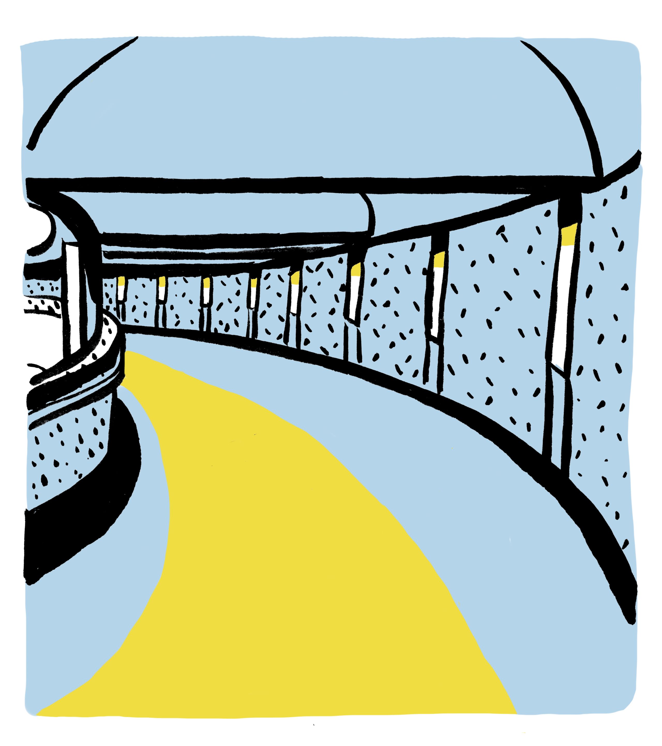
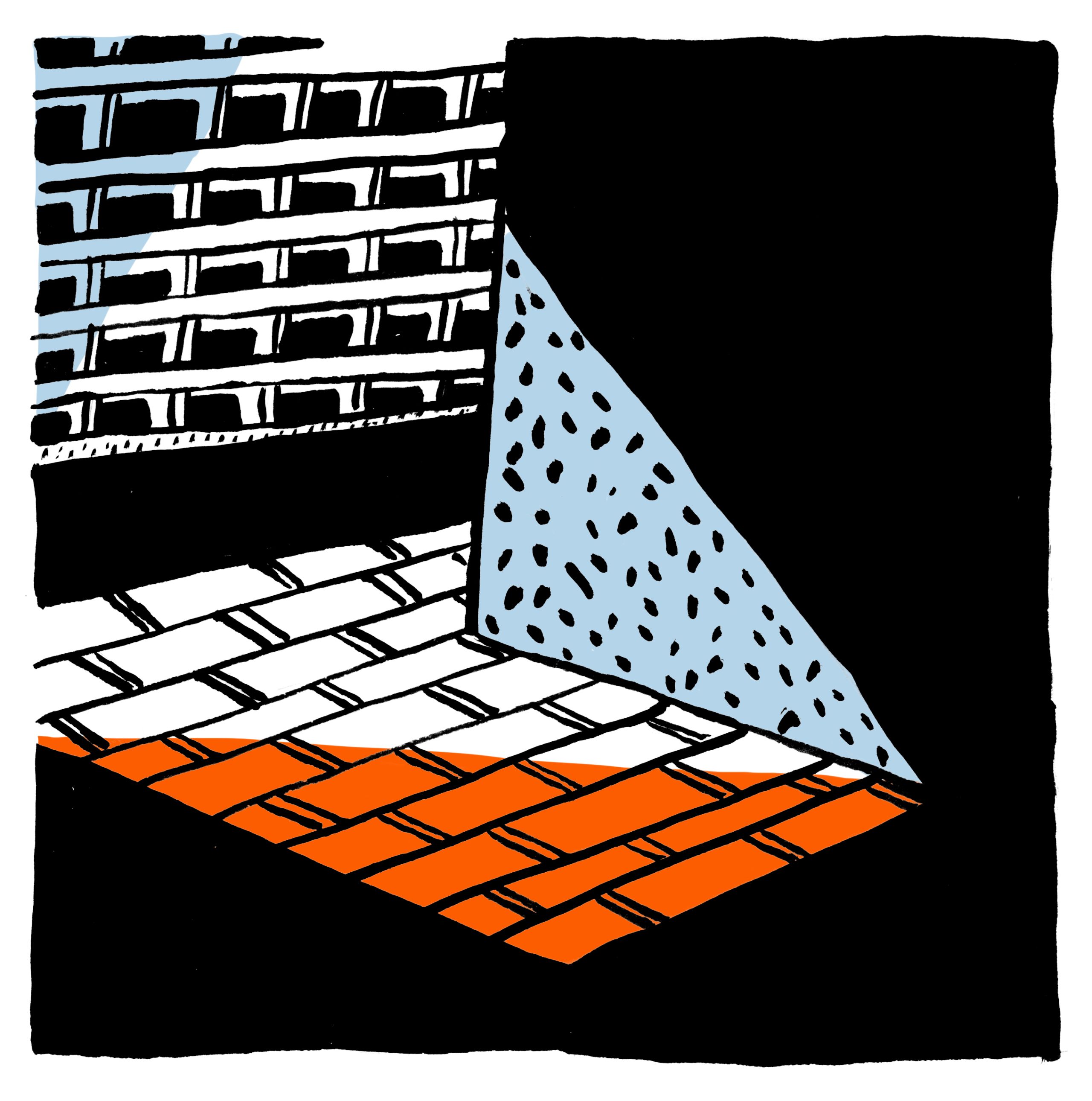
Entering the curved and covered Seddon Highwalk draws you into the architect's creative expression of architecture as fortification. Look out for design elements representing arrow slits, turrets and castellations*. Why? Well the Barbican comes from the medieval Latin word ‘Barbecana’ which means fortress and at this western edge of the Estate you can see how modernist architecture can resemble a walled citadel.

Photography Prompt: Shadow and light
Use the openings in the highwalks as a ‘frame within a frame’...
The architect Corbusier, acknowledged as an inspiration for the Barbican, said: ‘Architecture is a learned game, correct and magnificent, of forms assembled in the light.’ On this section of the walk pay attention to the contrast of shadow and light. Architectural forms cast shadows, and these help us to see and understand spaces especially when representing it in a two-dimensional photograph. Use the openings in the highwalks as a ‘frame within a frame’ to further give a sense of depth to your images.


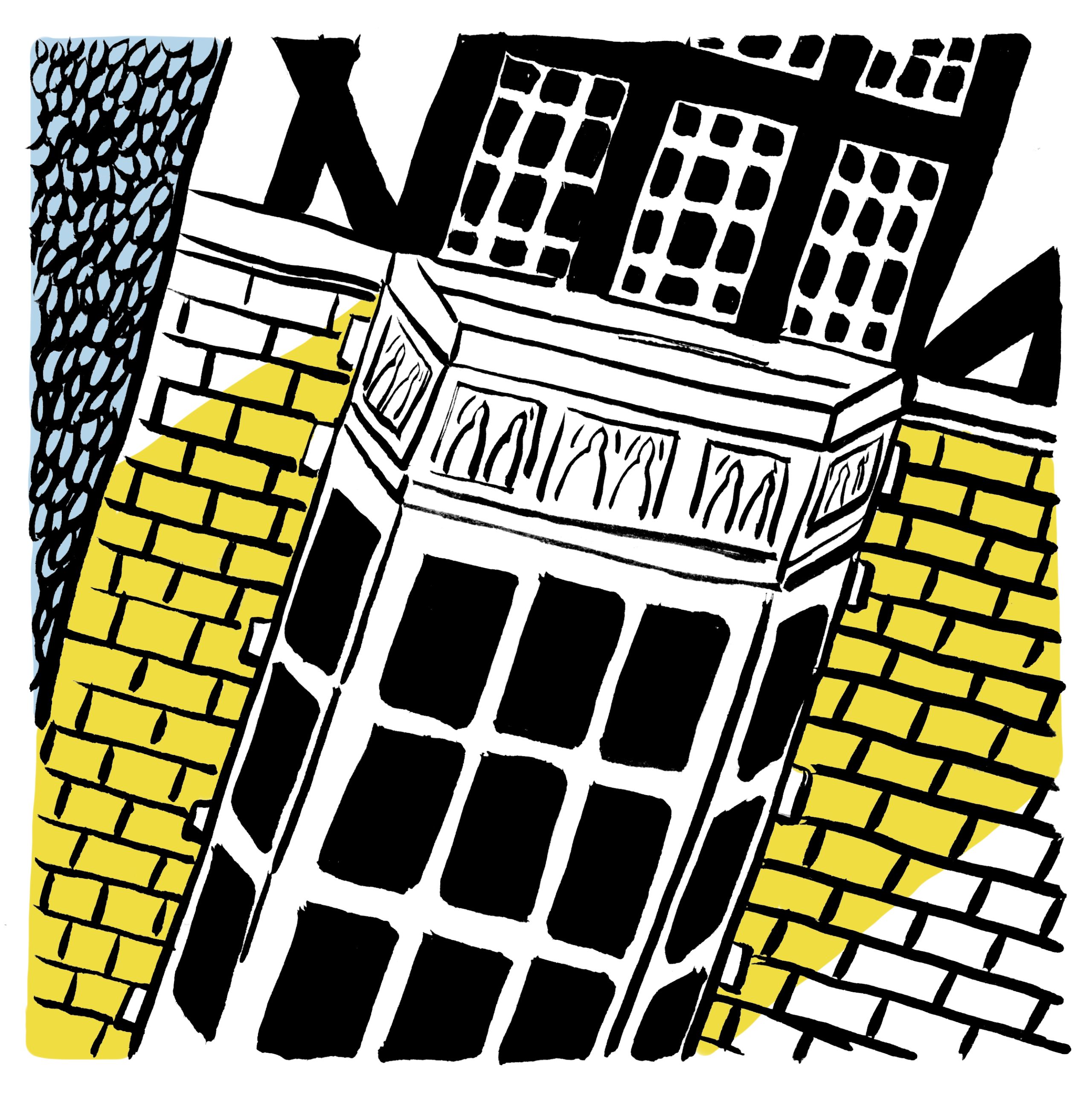


Ironmongers’ Hall
Directions: From the junction of Seddon Highwalk and Thomas More Highwalk, detour right into John Wesley Highwalk. Follow, turning left, then right until you reach Ironmongers Hall which will apear on your left, identified by it's rusty orange coloured wall.
Walking time: 5 minutes
Distance: 0.1km
The Ironmongers’ Hall is an architectural mix with Tudor beams, Gothic windows, and Edwardian brick. Built in the 1920’s, it is nothing like the Art Deco and Modernist buildings that were emerging in London during this decade. Instead, it appears like a country house which, a hundred years on, continues to be the home of the Worshipful Company of Ironmongers, the tenth of the Great Twelve Livery Companies of the City of London.*

Photography Prompt: Colour
Find strong individual colours or complimentary colours...
Colour stands out within the tonal uniformity of the concrete on the Barbican Estate. Find strong individual colours or complimentary colours such as blue and orange, red and green or yellow and purple as these work well together. To get even more attuned, try making a series of photographs with only one colour and then afterwards review how these images work together as a photography project.


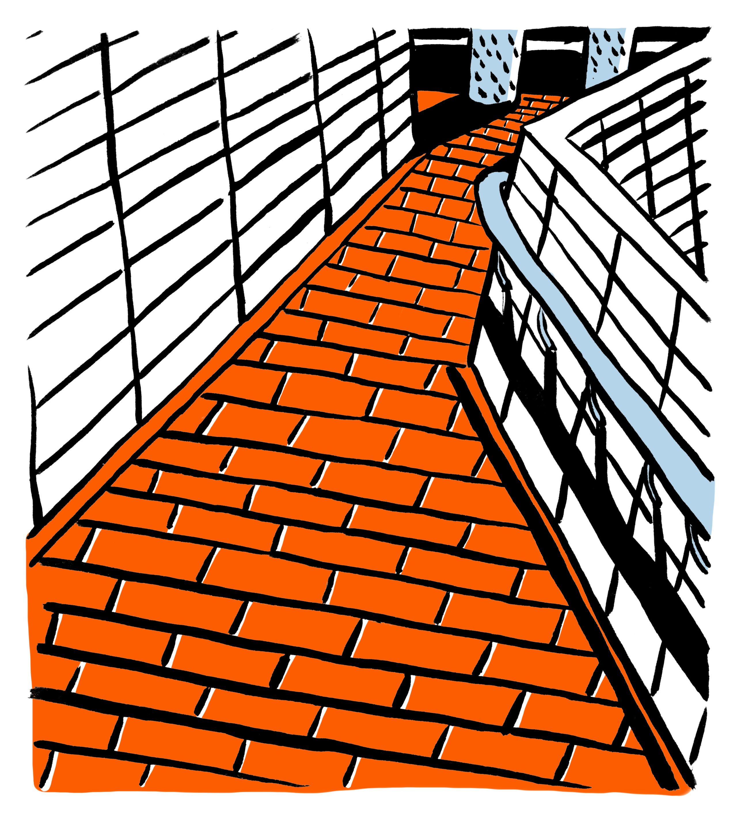
Wallside and the Roman Wall
Directions: Return along John Wesley Highwalk and turn right onto Thomas More Highwalk. Keep following into Wallside Highwalk from where you will look down to the circular stone bastions of London’s historic Roman Wall and the Church of St Giles’ Cripplegate* on your left.
Walking time: 10 minutes
Distance: 0.3km
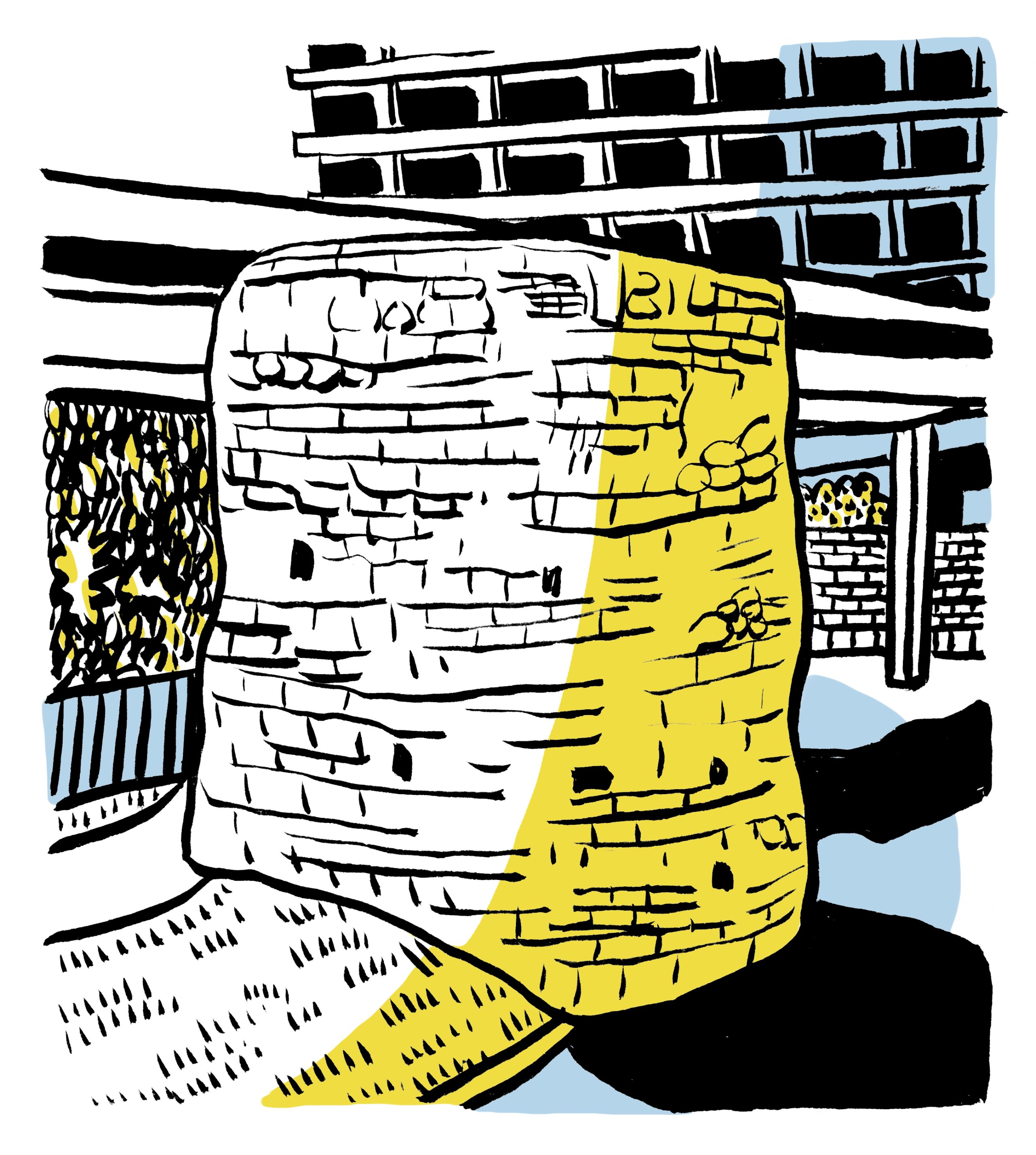
Like a Roman Road, this section of the walk continues in a very straight line along the Wallside highwalk with views over the oldest built features of the Barbican Estate. These include the remains of the Roman Wall which is visible below Wallside. The wall and bastions are from the Tudor period and not from the Empire’s occupation of Londinium in the 3rd century AD but the feeling of historical place remains.
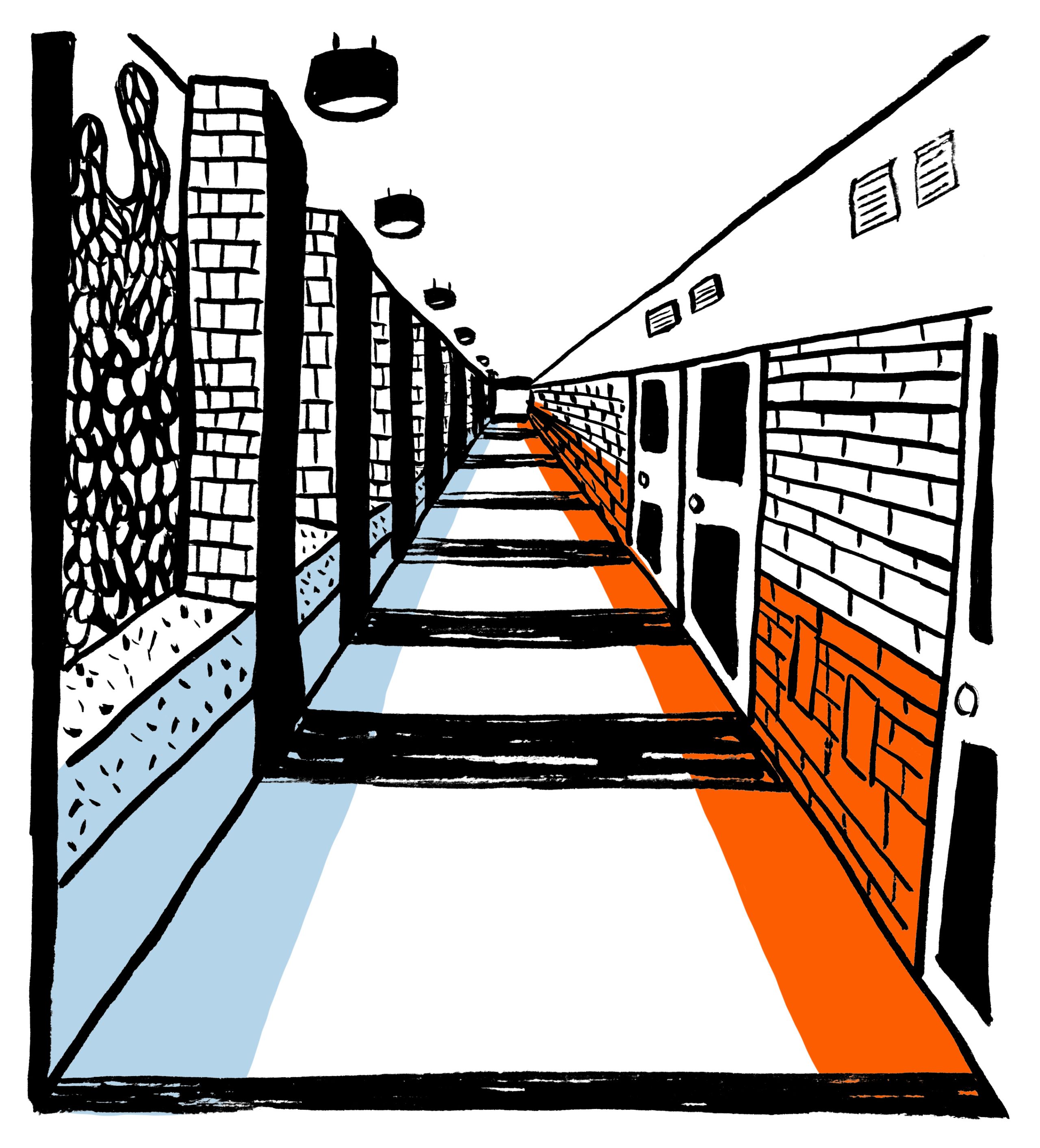


Photography Prompt: Perspective
Hold the camera level and experiment with aligning so the Highwalk converges along perspective lines...
In the sixteenth century, Sebastiano Serlio* was the first architect to write an entire book dedicated to perspective. In it, he explained how to draw in three-dimensions using vanishing point, perspective lines and the horizon. Photographers use the same ideas and the straight lines of the Highwalks are perfect for exploring perspective to create realism and a sense of depth. Hold the camera level and experiment with aligning so the Highwalk converges along perspective lines to an imaginary vanishing point. Try with the camera at different heights to change the position of the horizon line in the photographs.


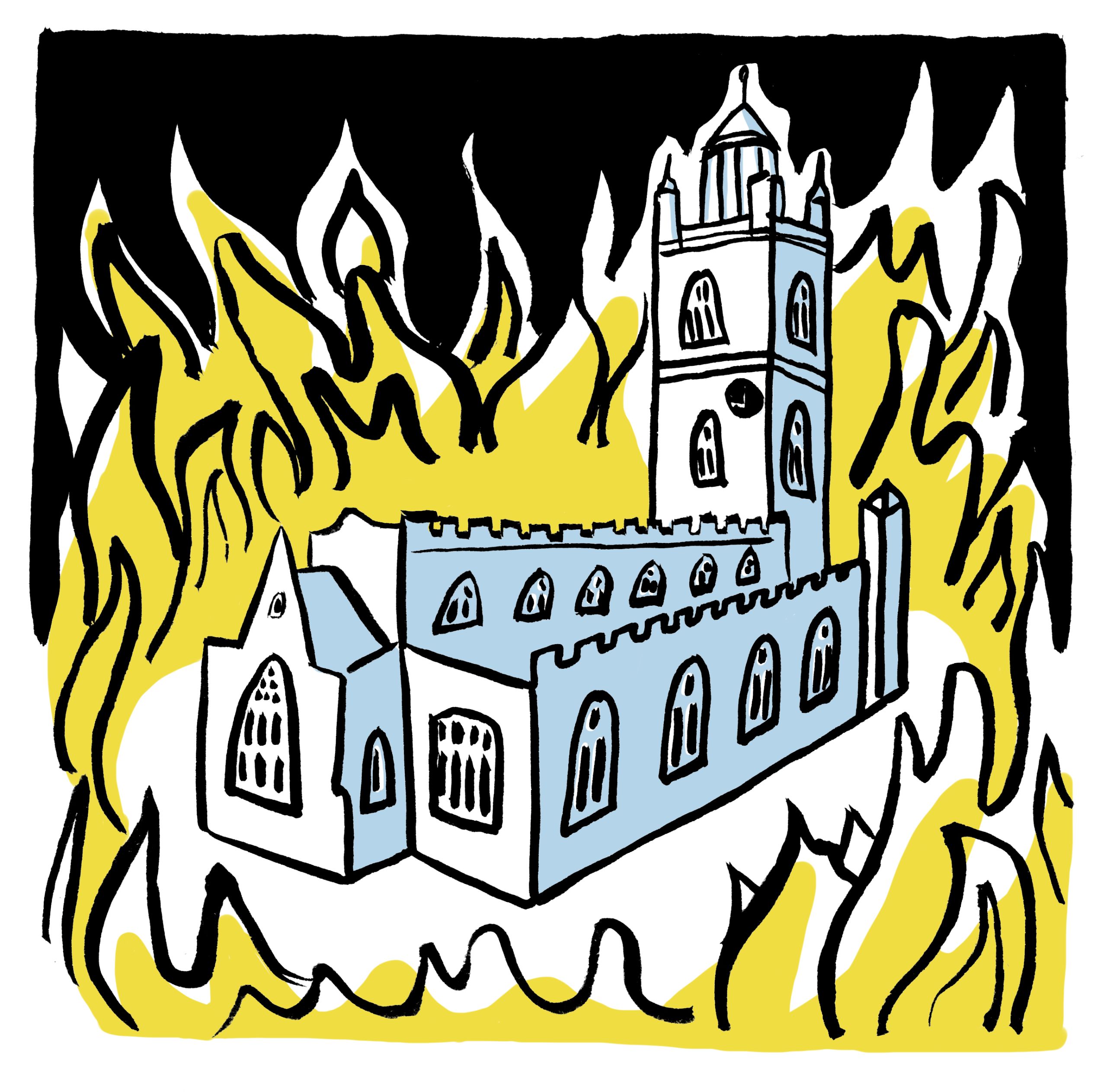


The Church of St Giles, Cripplegate
Directions: At the end of Wallside, having passed on your right the front doors to some of the Barbican’s five-storey terraced houses, turn left into the Postern*. At the end, take the steps (or lift) down to St Giles Terrace for a closer view of the church.
Walking time: 10 minutes
Distance: 0.3km
The original church on this site is thought to have been 11th century but this burned down in the middle of the 16th century. Rebuilt, it survived the Great Fire of London in 1666 and remains one of London’s largest pre-fire churches. Modernised during Victorian times, the church suffered bomb damage in 1940. It was this heavy destruction of Cripplegate* during World War Two led to the realisation of a plan to rebuild the area and from which the Barbican development was devised.

Photography Prompt: Place
Architecture should speak of its time and place, but yearn for timelessness
Frank Gehry*, Architect
Keep this in mind as you finish the last sections of this guided walk and try to make images that convey the sense of place you have experienced along the way. How you do this is a very much a personal choice but think about architectural design and details, objects and materials, as well as vistas and views.
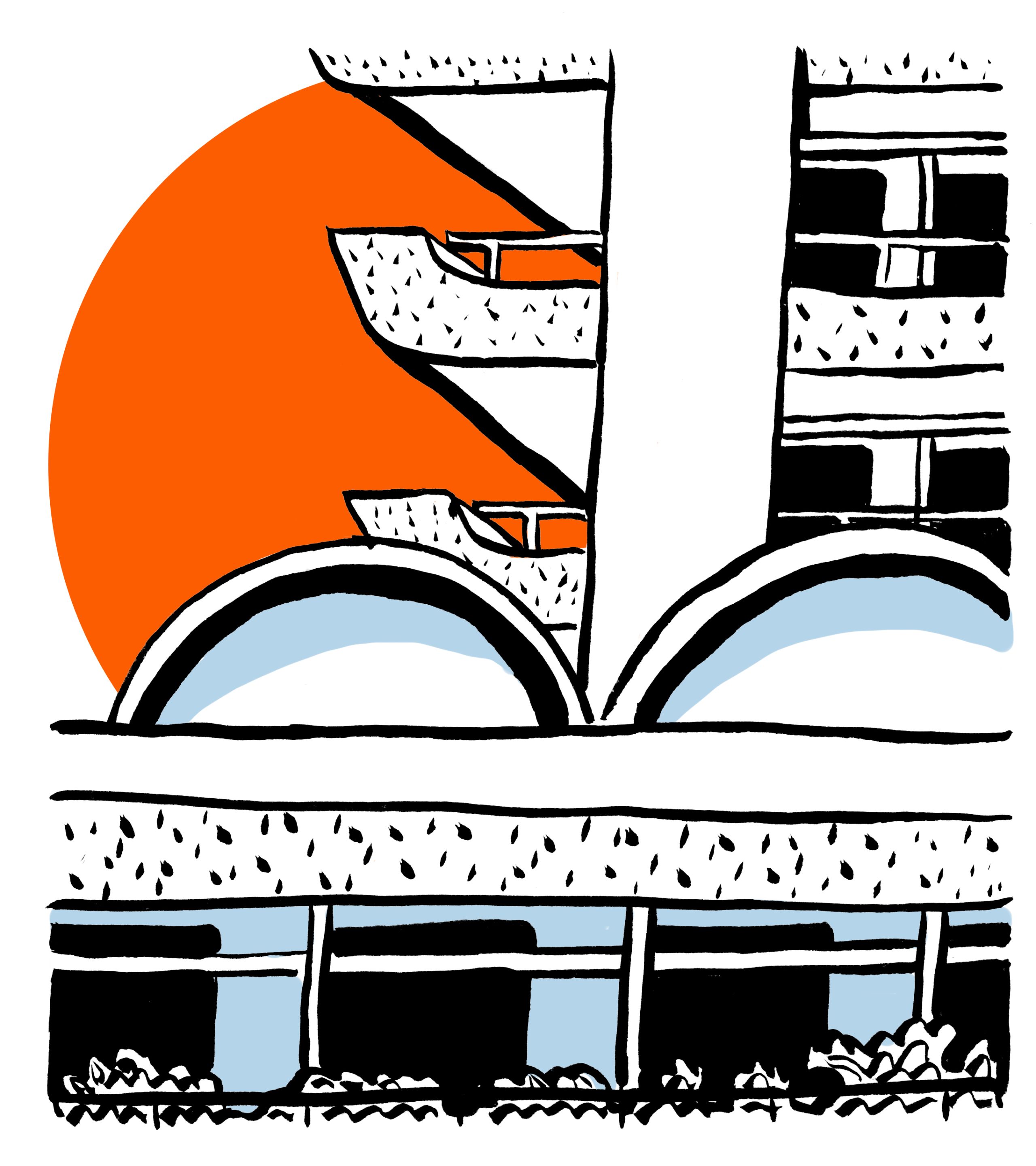
The End - Gilbert Bridge
Directions: Return to the steps (or take the lift) and once back on the elevated level of the Highwalk cross onto the Gilbert Bridge in the direction of the Barbican Centre.
Walking time: 5 minutes
Distance: 0.1km
When crossing the Gilbert Bridge, recall the idea of the Barbican as a fortress and specifically how this walkway resembles a drawbridge across a moat. There are wonderful views across the lake with the Barbican Centre to the left and the waterfall with City buildings beyond. Look downwards too as it’s not uncommon to spot the resident heron still and patient and other wildlife that all live in this unique city centre location.
To exit, either turn back on yourself or walk to the end of Gilbert Bridge and at the end continue onwards before turning right along the Highwalk under Speed House.
Access to the Centre is currently restricted. If you'd like to enter the Centre after your walk please return to ground level and enter via the Silk Street entrance or the Lakeside. If you want to go into the Centre we ask that you check in using the NHS Test and Trace app.


Glossary
- Brise Soleil: An architectural feature of a building that reduces heat gain within that building by deflecting sunlight.
- Castellations: Defensive or decorative parapets with regularly spaced notches.
- Chamberlin, Powell and Bon: A British firm of architects whose work involved designing the Barbican Estate, considered one of the most important modernist architectural firms in post-war England.
- Corbusian: Characteristic of the Swiss architect Le Corbusier, one of the pioneers of modern architecture and influential in urban planning, whose designs combined functionalism with bold sculptural expressionism.
- Cripplegate: A gate in the London Wall which once enclosed the City of London.
- Frank Gehry: A Canadian-born American architect. His works are cited as being among the most important works of contemporary architecture. Elements of his design often appear fragmented and are described as chaotic or disjointed.
- Great Twelve Livery Companies of the City of London: Trade associations of various crafts, trades or professions. Responsible for training and the regulation of wage control, labour conditions and industry standards.
- John Nash’s Park Crescent: Elegant stuccoed terraced houses by the architect John Nash, which form a semicircle.
- Nigel Dunnett: Professor of Planting Design and Urban Horticulture at the University of Sheffield, one of the world’s leading voices on innovative approaches to planting design.
- Postern: A side entrance.
- Sebastiano Serlio: An Italian Mannerist architect, painter and theorist who was part of the Italian team building the Palace of Fontainebleau.
- Steppe grassland: Steppes are semi-arid regions with grasses and plants adapted to the harsh, dry conditions.
- Syncopated: Describes music or a rhythm characterized by displaced beats or accents so that the strong beats are weak and vice versa.
Keep exploring...
If you’re interested in finding out more about the architecture of the Barbican use your 20% discount to book on one of our 90 minute Architecture Tours led by our expert guides, visit our Archive page or visit the Barbican Shop for books about the Barbican.
While visiting the Centre why not take advantage of our other benefits; enjoy some retail therapy with 15% Member’s discount in the Shop, book a slot in advance to visit our exhibition, Jean Dubuffet, Brutal Beauty for free or catch a film with 20% off at the Cinema.
Illustrations by Annie Ward. See more of Annie's work in our Archive Sketches series on Instagram.
Route devised by photographer, Anthony Palmer, who runs our in person Architecture Photo Walks. Find out more information about his work on his website.